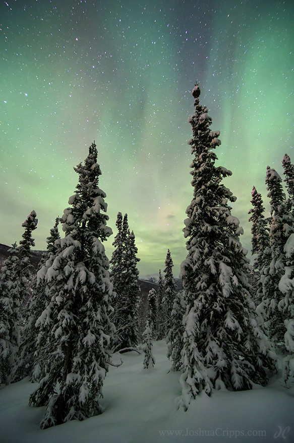
[av_heading heading=’Behind the scenes of this photo’ tag=’h3′ color=’custom-color-heading’ custom_font=’#949494′ style=” size=” subheading_active=” subheading_size=’15’ class=’alignleft size-full wp-image-5368′ src=’https://www.joshuacripps.com/wp-content/uploads/2014/02/aurora-borealis-chena-hot-springs-alaska.jpg’ alt=’Aurora Borealis, Chena Hot Springs, Alaska’ width=’583′ height=’880′ />dding=’0′ av_uid=’av-30tq3a’][/av_heading] Taken at the Chena Hot Springs resort near Fairbanks, Alaska, on January 1st, 2014 Anyone who watches The Simpsons may get the joke in the title here. […]
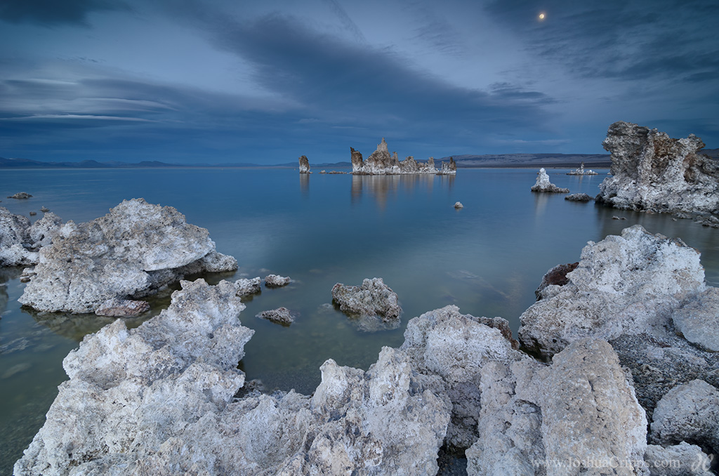
[av_heading heading=’Behind the scenes of this photo’ tag=’h3′ color=’custom-color-heading’ custom_font=’#949494′ style=’blockquote classic-quote’ size=” subheading_active=” subheading_size=’15’ padding=’0′ av_uid=’av-2vsto6′][/av_heading] Taken in deep twilight at Mono Lake South Tufa on February 12th, 2014 I hate Manifest Destiny. The idea that American colonists were destined to expand across the west to conquer its lands and its resources makes me want […]
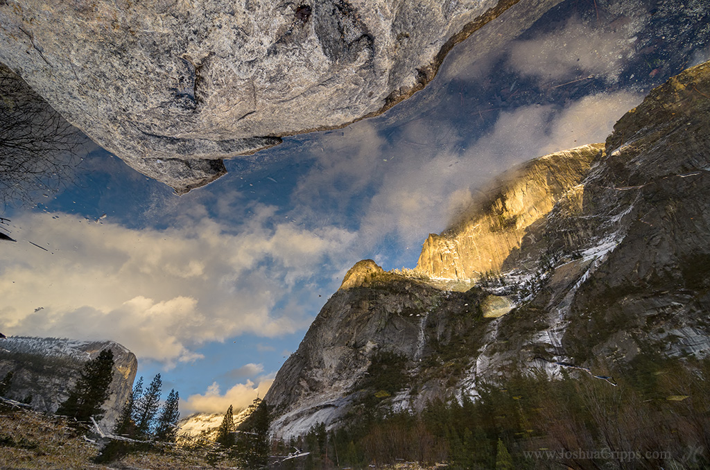
[av_heading heading=’Behind the scenes of this photo’ tag=’h3′ color=’custom-color-heading’ custom_font=’#949494′ style=’blockquote classic-quote’ size=” subheading_active=” subheading_size=’15’ padding=’0′ av_uid=’av-24lay5′][/av_heading] Taken at Mirror Lake, Yosemite National Park on February 3rd, 2014 So the thing about Half Dome is that it’s big. Really big. Like sticking almost-a-mile straight up out of the ground big. And Mirror Lake in […]
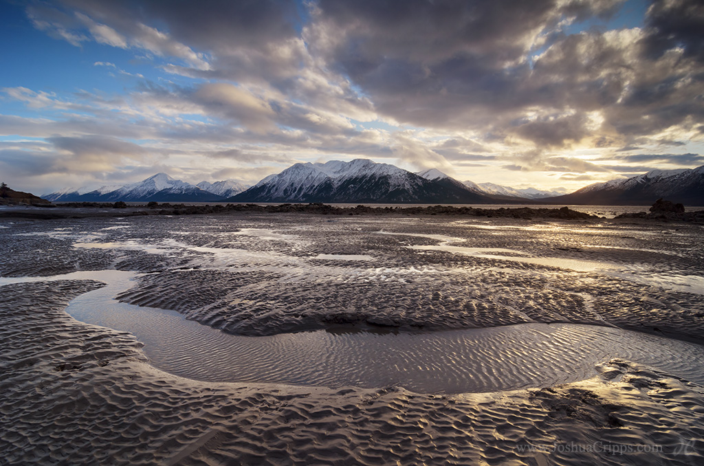
Taken in Alaska along the Turnagain Arm of the Cook Inlet near Windy Point on January 5th, 2014 Alaska is an alluring place and attracts folks for a multitude of reasons. 120 years ago thousands of folks headed north driven by the lure of riches in the Klondike Gold Rush. On a winter trip to […]
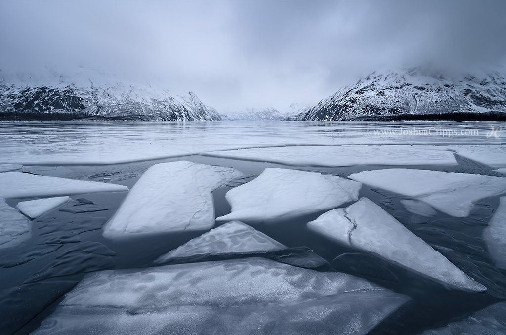
Taken at Portage Lake, Alaska, on January 6th, 2014 On a mildly windy, 25 degree day toward the end of a three-week winter trip to Alaska my friend and I decided to check out Portage Lake to see if it was frozen over or not. We arrived under overcast and slightly wet conditions to find […]
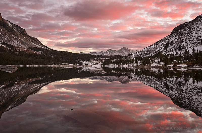
Taken at Tioga Lake near Yosemite National Park on November 12th, 2013 While running down the east side toward Death Valley for a workshop I lucked into a great sunset over the Yosemite high country. A recent storm had left snow above 9,000 feet and the high peaks above Tuolumne Meadows were particularly striking. The […]
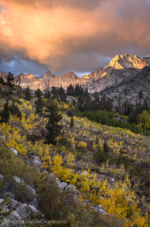
Taken in Bishop Creek Canyon, Eastern Sierra Nevada, California on September 25th, 2013 It started with breath, which became a bluster. By nightfall it was a constant howl. At three in the morning it huffed and puffed and blew my tent away. And by sunrise on the 25th of September, the wind had become a […]
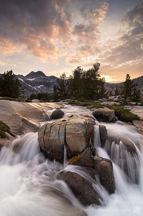
Taken near the Marie Lakes, Ansel Adams Wilderness, Eastern Sierra, on July 3rd, 2013 There are a few pieces of photography equipment I consider indispensable when I’m in the backcountry: a camera and tripod of course, and a few filters and accessories. Who would’ve ever thought I’d wish for a chainsaw or a ladder to […]
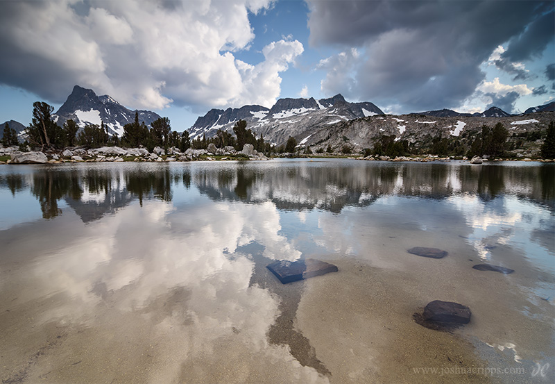
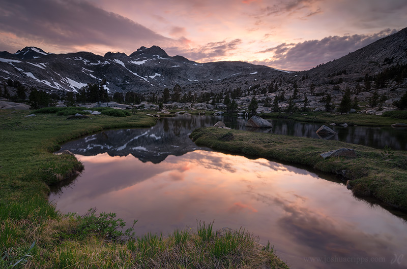
Taken at Island Pass in the Ansel Adams Wilderness, Eastern Sierra Nevada, on July 4th, 2013 Why do photographers do the things we do? Why do we hike so much our packs chafe us raw? Why do we huff, puff, and sweat our way over 11,000 foot passes? Why do we subject ourselves to the […]
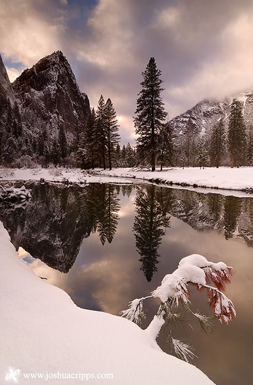
Taken from the banks of the Merced River in Yosemite Valley on December 27th, 2012 It’s become somewhat of a tradition for me to snow camp in Yosemite during the week between Christmas and New Year’s Eve. This year, on my first night in the trip I walked along the Merced to one of my […]
Taken in the Marie Lakes Basin in the Ansel Adams Wilderness just east of Yosemite on July 3rd Early July 2013 brought sweltering temperatures to California, and the extreme heat resulted in thunderstorms and clouds building along the Sierra crest for days at a time. I planned a backpacking and photography trip from Tuolumne Meadows […]
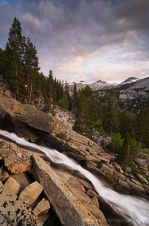
Taken deep in the Lyell Canyon in Yosemite National Park on July 2nd, 2013. Having hiked about 8 miles into Lyell Canyon from Tuolumne Meadows I noticed beautiful Kuna Creek cascading down the eastern flank of the canyon. Thinking the creek might provide an interesting viewpoint for a photo, I waded across the (freezing) Tuolumne […]